
Walk a Cary Street Directory
For most Cary addresses, begin with the Town map and then route the parcel to its county. Cary lies in Wake, Chatham, and Durham Counties, so the postal city alone does not identify the tax office, deed index, or election custodian. The map is the geographic check. The county parcel record identifies the property record. A recorded instrument and a voter record can then supply separate, limited forms of confirmation.
Use the same method for each address rather than assuming an entire street belongs to one system. Ownership and a mailing contact may appear in a tax record. A registration result may show one registered voter at an address. Neither establishes every person who is present there. Cary street-by-street research is stronger when each result is saved with its county, date, parcel identifier, and the named person's actual role.
- Enter the address in the Cary Property Research Map and check the county, town-limit, ETJ, ZIP, street segment, and parcel context.
- Search the responsible parcel system. Most Cary parcels use Wake Real Estate Search; use the Chatham or Durham system when the map puts the parcel there.
- Record the owner of record, property address, mailing address, Real Estate ID or PIN, legal description, and any deed reference before moving to the next address.
- Open the county Register of Deeds index for the recorded deed, plat, map, easement, or release that explains the parcel's legal trail.
- For registered-voter evidence, use NCSBE Voter Search by name and county, or ask the proper county board about a legally releasable county or precinct list.
- Use the library's address-oriented directories and newspapers only after the current parcel is pinned down, especially when the question concerns an earlier household.
Note: A Cary address may be in a different county system than the adjacent address, so confirm parcel geography before interpreting any name.
Cary Street Directory Address Fields
Wake Real Estate Search is the practical address route for much of Cary. Its design matters. Street type is omitted from the street-name field, and a partial or ambiguous street can produce a refinement list. The owner route requires a last name for an individual, while the business-owner field serves entity records. The PIN route separates map, scale, block, and lot, and Wake states that scale is a map index rather than part of the ten-digit PIN.
These fields make a Cary address search more precise than a broad name search. Enter only what the portal asks for, capture the resulting parcel identifiers, and read the property address apart from the owner mailing field. Wake changes live screens and labels, so compare the result to the current portal before relying on a printed field name.
| Field Label | Type | Required | Options / Format Notes |
|---|---|---|---|
| Last Name | text | yes for individual owner search | owner surname |
| First Name | text | optional | individual given name |
| Middle Name | text | optional | initial/full as indexed |
| Business Owner Name | text | optional/alternative | entity search |
| Real Estate ID | text | optional alternative | example 0185211 |
| Street Number | text/number | optional alternative | address route |
| Street Name | text | optional alternative | omit street type such as rd/dr; refine street list if ambiguous |
| Map | text | optional PIN route | map index |
| Scale | text | optional | not part of 10-digit PIN; map browsing aid |
| Block | text | optional | PIN subdivision field |
| Lot | text | optional | PIN subdivision field |
Cary GIS Layers Along a Street
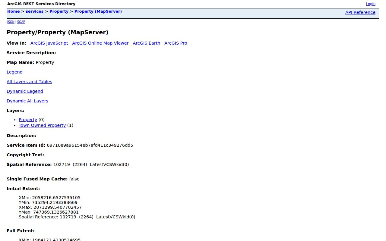
Cary's Property Research Map adds the context a parcel card cannot. Its property service has Property and Town Owned Property layers and supports identify, query, find, and map export operations. The related Administrative Areas service includes County Boundaries, ZIP Codes, Cary Town Limits, Cary ETJ, other municipal boundaries, and the Urban Service Area. Cary also describes zoning, flood, utility, land-use, development-plan, annexation, and recorded-plat layers.
The Town map can point to a parcel, but it is not title evidence. Parcel lines may be generalized, ownership may lag a recording, and planning overlays serve a different purpose from a deed. Use the map to orient a Cary address result, then verify property ownership and legal descriptions through the county office and recorded instrument.
The Cary Property service shows the Property and Town Owned Property layers with identify and query controls.
Use the selected parcel to move to the county property record, then compare its PIN and legal description with the deed index.
Cary Street Permits Mark Change
Permit records add a work timeline to an address, not a list of occupants. Cary makes permit data since 2009 available through its Open Data Portal, including applications and inspections. The Town also provides address or permit-number searching for applications, payments, and inspection information. A permit can identify an applicant, owner, contractor, project description, issue or status date, and inspection event. Those roles should remain distinct in a Cary address search.
For a record before the Town's online period, Wake's older permit search covers records before July 1, 2018 and permits searches by applicant, permit number, owner, address, and PIN. The overlap is useful for a transition check. If neither online source has the needed row, Cary's Inspections and Permits Department accepts counter, phone, and email contact at Town Hall. A targeted North Carolina Public Records Act request should name the address, permit type, date range, and fields sought.
Note: A permit dates a project or inspection event; it does not establish who was present at the address after the work ended.
Three Custodians for Cary Streets
The Town of Cary confirms that its limits cross Wake, Chatham, and Durham. Wake is the primary county, but a Cary address on the edge can require a different assessment, land-record, and deed route. Start with Cary's county-boundary layer rather than a mailing address. Then keep the parcel in the system of the county that assesses and records it.
For a Chatham-side parcel, use the Chatham Register of Deeds for recorded instruments and the Chatham Land Records map for address, parcel-number, or owner searching. Chatham says its GIS is also the route for a next-parcel ownership question. For Durham-side Cary, the Durham real-estate records search and Durham Land Record GIS provide the matching channels.
Each county also has an in-person records path when an image, older book, certified copy, or mapping explanation is needed. Do not carry Wake's field rules, coverage dates, or mapped acreage assumptions into the Chatham or Durham result. Cary is the shared place name, not a shared county database.
Cary Street Record Chain
Address-keyed records answer different questions along a Cary street. The tax parcel links a name or entity to a property record. GIS locates that parcel inside county and Town boundaries. The deed index supplies the recorded parties and legal description. A voter record is limited to registration. A library source can place an earlier named occupant at an address. Read the chain as corroboration, not as one merged identity record.
| Address Record | Cary Custodian | Street-Level Detail | Access Route |
|---|---|---|---|
| Assessment and tax parcel | Wake, Chatham, or Durham tax administration | owner, mailing and situs addresses, PIN, value, legal description, tax bill | county portal and counter |
| Property Research Map | Town of Cary GIS | parcels, town limits, ETJ, utilities, zoning, flood and plats | free online map |
| Deed or plat | county Register of Deeds | parties, recording date, book/page, legal description and prior references | online index/image and counter |
| Permit or inspection | Town of Cary or Wake County | address, project, application roles and inspection chronology | Cary data, older Wake search, or request |
| Voter registration | NCSBE and county board | registered name, address, status, precinct, district and history | name search or permitted request |
| Historic directory or newspaper | Olivia Raney, archives, and library collections | address-oriented historical lead or named event | reference, microfilm, scan, or staff help |
The parcel identifier is the bridge between current assessment data, map layers, permits, and recorded documents. The street name is only a search aid. A street can change context through annexation, subdivision development, or a new county boundary layer, while a lot, block, subdivision, or legal description continues to identify the land.
Cary Deeds Across the 2025 Split
Wake's land records span two web applications. The legacy Consolidated Real Property Index states that recorded documents from July 1785 through April 17, 2025 are viewable in that system. Wake launched its new Records Management application on April 21, 2025 for the post-migration period. Search both systems around the handoff and ask the Register of Deeds counter for help when a transition-date document does not appear where expected.
The legacy Wake index permits document-type, grantor, grantee, date, and book/page searching. It asks for individual names last name first, recommends spelling variants and fewer characters, and warns that the index resembles a card catalog rather than the underlying instrument. The new Wake Records Management application is the later channel. For older maps, search book values with BM plus a four-digit year, or CM plus the year for condominium maps.
Cary Street Record Terms
Old Cary records often use land language rather than the current street number. Frank Page laid out early streets after acquiring land in 1854, and Cary's later annexations and subdivisions broadened the address landscape. Green Level Church Road and Green Level West Road preserve a crossroads history that can require an old road or community-name search. When a current address fails, move from the parcel to its legal description, subdivision, plat, and map references.
- Parcel
- A mapped unit of land used by the tax system. Its PIN or Real Estate ID helps connect a Cary property record to the deed and map trail.
- Situs address
- The physical location of the parcel. It is different from the address where a tax notice is mailed.
- Plat
- A recorded map that can show a subdivision, lot, block, streets, easements, and boundaries. It can bridge a present address to an older tract description.
- Criss-cross directory
- An address-first historical directory. It can point to a named occupant for a particular period, but its coverage and inclusion must be checked volume by volume.
Wake library holdings include official plats on 1885–1950 microfilm and a plat index to 1981. Olivia Raney Local History staff can help locate those materials and historical directories. The collections themselves are discussed with their publication runs on the Cary city directory page.
Cary Street Search Limits
A Cary street search cannot identify every person connected with an address. It does not supply a full household list, utility customer names, delivery-account details, full DMV address data, protected voter locations, sealed court material, or confidential vital-record details. A tax owner may be an entity, trust, estate, or trustee. A mailing address can be outside Cary. A voter match covers registration, not every person at the property. Treat every public result as a specific record, not a claim about private daily life.
Lawful use. Cary address records support personal, family-history, property-history, and civic research. Do not use information from a record to stalk, harass, intimidate, or harm another person; North Carolina law prohibits stalking.